
-
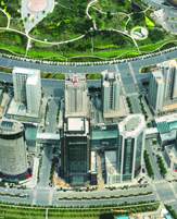
Data Acquisition
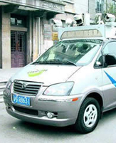
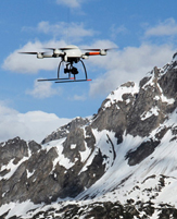
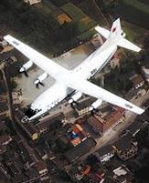
Fixed-wing aircraft photogrammetry engineering, UAV photogrammetry engineering, automotive mobile measurement engineering
-
-
Our Advantages
Familiar with the category mainstream aerial sensors, especially for photography tilt sensor in engineering applications has accumulated rich experience
Advanced airborne sensing equipment: ADS80, ALS60, RCD30, SWDC-5, MIDAS
Emphasis on cost-effective optimization: Based on the outcome of the request, the introduction of a variety of sensor technology or the rational allocation proportion of its use outside the industry, thereby enhancing the spatial data acquisition of automation and efficiency
-
-
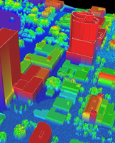
Data Processing
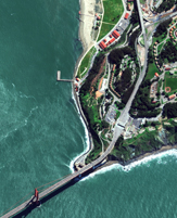
Panorama true three-dimensional data, 4D data, satellite data
-
-
Our Advantages
Proprietary technology & mdash; & mdash; true three-dimensional building systems 3DRealWorld & trade ;, the only technology with independent intellectual property rights
Advanced graphics image processing workstation
Strict quality control system
-
-
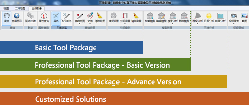
Application Service
True three-dimensional data can be used Huazheng platform for application platform, you can also use other industry mainstream dimensional GIS platform (supported .x and 3ds format).
-
According to the function, application platform can be divided into:
Basis Kit: contains the basic functions / tools
Multiple industries Version: planning, urban management, land, real estate, etc., and is divided into [Basic Edition], [Extended Edition]
Customized services: to meet specific application requirements.
Product & Service
HuaZheng provides service of data acquisition and post-processing, and customized solutions according to the end-user’s requirements.
For both field and indoor works, HuaZheng team have the best abilities and experiences